Friday, July 8, a small fire broke out on Hayden Creek. The reports are that it was a lightening strike. I have recently posted about the Shradsky property might have been located on the Hayden Creek Road, so this is just to the south west of Cotopaxi.
I made this map to give you a better idea. The blue areas are where the colony plots were. The red arrow is approximately where the fire is and the direction it is headed. Maybe 4 miles as the "crow flies".

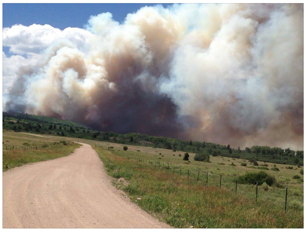
This photo was taken by someone who lives in Cotopaxi just about an hour ago (Sunday, July 10, 4 pm), looking past the Cotopaxi School to the west. The fire has broken out. Flames are shooting 200' into the sky. It is blowing from the Southwest.


UPDATE July 14, 5:45 pm. They have been dropping water and fire retardant along the east side of the fire. While the middle is still burning, there is no growth to the east. Hopefully they can now keep it contained. The colony lands appear to be safe for now.
UPDATE July 16 5:15 am. Here is a decent website with photos: Pueblo Chieftain. The fire has consumed almost 16,000 acres. It is 5% contained. It will burn until October when the snows come. Residents that were evacuated will not have access for up to 2 more weeks. Over 600 firefighters working the fire today.
*********c2016Cotopaxi-Colony.blogspot.com All content is copyright protected and may not be copied, reproduced, reused or reposted in any manner without permission.
No comments:
Post a Comment