Showing posts with label Grand Canyon of the Arkansas. Show all posts

Saturday, October 1, 2016

The Grand Canyon of the Arkansas

That is the 1882 name for what is now known as the Royal Gorge.  Today, we took a train ride up through the canyon to get some photos as it hit me that people who are not from here might want to see what the Colonist saw when they left Canon City heading west to Cotopaxi.

Remember that the train stopped every 7 -10 miles to fill up with water and every 25 miles to add coal.  Since it's 35 miles to Cotopaxi it took awhile for them to get there.

I decided to take photos showing todays train so you could get an aspect as to size and distance.  This is what it looks like when you leave town.  These water diversion gates were not there in 1882....but the landscape was the same and the lack of trees probably the same.


As you round the first couple of corners, you start to see a few more peaks.


Then the river gets more narrow as the peaks get taller


This is the first glimpse of the suspension bridge at the top - you can barely see it, but you can get an idea as to how flat and sheer some of the cliffs in the canyon are.


I wonder what the Colonists thought?  They must have been overwhelmed at the depth of this canon. Of course, the bridge was not there.  And they would have been on a narrow gauge train.  A much different experience than today's ride.


These days, some of the river walls have been cemented in due to floods and erosion of the ground under the tracks.  On the left is a water pipeline that did not exist in 1882.
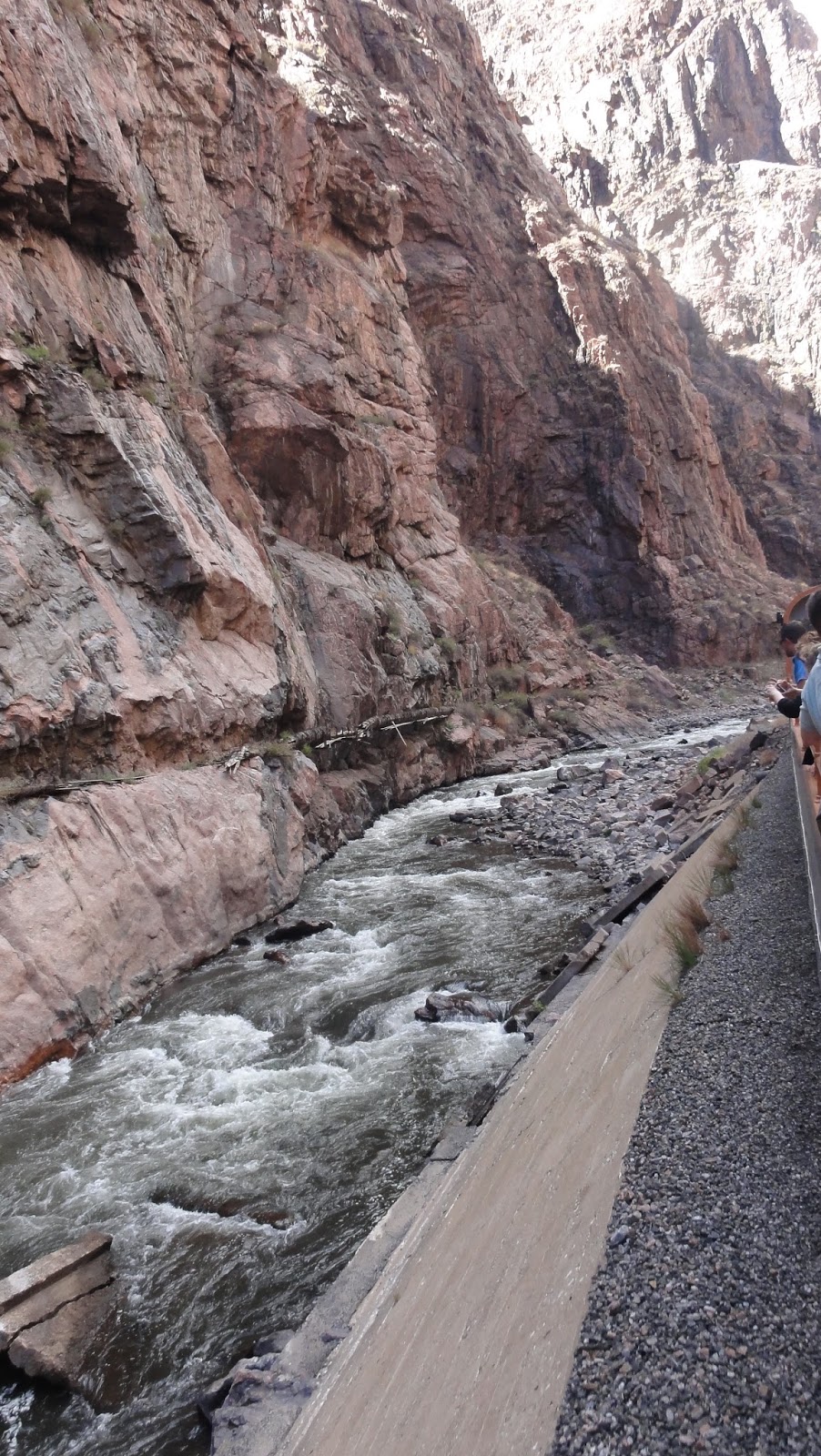

This photo shows the jaggedness of the peaks going through the canyon.


And this is pretty much the scenery anywhere there is land you could walk on.  Filled with cactus and small shrubs.  Hard to believe this is just a few feet from the river, yet absolutely nothing grows here.


The train stops at Parkdale and then you come back to Canon City.   From Parkdale, the highway follows the train the rest of the way to Cotopaxi.  But if you drive it today, you just will not see what they saw going through the Royal Gorge.

 I was able to get this shot of the water showing how shallow it is.  
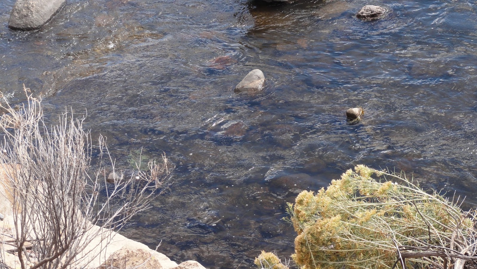

Today, rafting is the main industry of this river.  But in the 1880s, logs were cut and then put in the river and floated downstream to Canon City and Pueblo.  This is at Parkdale where the early pioneers ran up to 5000 head of cattle and they crossed the Arkansas here.  That would have been something to see!


On the way back, I was able to get this closeup of the suspensions that support the train tracks through the narrowest part of the canyon.


They were told that they could farm the land and then they saw this.  I just think they had to have shook their heads in wonder!  I do and it's 2016!


*********c2016Cotopaxi-Colony.blogspot.com All content is copyright protected and may not be copied, reproduced, reused or reposted in any manner without permission.

Wednesday, May 11, 2016

How did they get to Cotopaxi?

Have you ever wondered how your ancestors got to their homesteads prior to current day highways?  If you head west out of Canon City today, Highway 50 takes you right to Cotopaxi.  And if you follow the posted speed limits - it's about a 45 minute drive.  But that road was not there in the 1800s.  So how did they get to Cotopaxi?

Currant Creek was the first road west of Canon City.  That would now follow Hwy 9 up to Guffey.  In 1868 there was a town named "Currant Creek" about 27 miles NW of Canon.  The Witcher's and Mulock's lived up there.  They moved to Cotopaxi later on.  John Witcher was one of the founders of the "Upper Arkansas, San Juan and Pacific Railroad" in 1878 - part of the 1880 train wars.  T.  Witcher ran 4000 head of cattle from Texas to Fremont County that year.  These men were interested in transportation.

In 1871, $1400 was raised to construct a bridge at Mccandless Ford (Parkdale).  The cattle crushed it and another $400 was needed to rebuild it a year later.

In the fall of 1872, $3000 was set aside for a road "up the Arkansas River."  It didn't follow the river.  This road began on the west edge of Canon City, followed today's Hwy 50 which was the Currant Creek Road, then branched off to the west, crossed the Mccandless Ford then continued up today's Copper Gulch Road.  It would veer west where Road Gulch is, then head south on 69, connect at CR 1A, and go on west from there.  At that time, Texas Creek was not located on Hwy 50.  It was south of Road Gulch on Hwy 69. This wagon road wasn't actually built until 1874, two years after the funding was established.

If you know the area, you can find that road on this 1881 map.  See "12 Mile Bridge" then go south.  No road to Cotopaxi.  Great map!


Where CR 1A hits Oak Grove Creek, the stagecoach road went west from there and came down to the Arkansas River in Pleasant Valley.  There was no road from that juncture to Cotopaxi.  Because Cotopaxi didn't exist!  Remember, this "Canon City to Leadville" wagon road was built in 1874 - 2 years before Colorado became a state.

That same year,  they tried to put a Wagon Road up Grape Creek to Soda Creek where it then joined Copper Gulch road.  At the cost of $25,000.  It was wiped out in a flood shortly afterwards.

The Royal Gorge as we know it today was called the "Grand Canyon of the Arkansas."  It was nearly a day's excursion from Canon City!  It was renamed the Royal Gorge by Rev. Richard Shelty in 1875.

Mccandless Ford was also known as Twelve Mile Ford.  It became Parkdale in 1879.  The Valley there was called "Webster Park".  They had a post office from 1888 to 1970.  Where Texas Creek is today used to be known as "Ford".

This is from a 1912 article showing the proposed Rainbow Route.


It wasn't until 1913 that state funds were set aside to build "the Rainbow Route" where Hwy 50 goes west from Parkdale.  This gravel road "highway" was to go to Salida and over Monarch Pass.  Construction on Monarch did not begin until 1919.

It was known as the Rainbow Trail until about 1926 when it was designated at Hwy 50.  It was paved sometime after 1931.

When you are researching your family history, ask the question - how did they get there?  Back in 1882 when the Colonists arrived in Cotopaxi, it would have taken 2 days to get there from Canon City by means of a stage coach.  Or they took the train.

***** c2016Cotopaxi-Colony.blogspot.com  All content is copyright protected and may not be copied, reproduced, reused or reposted in any manner without permission.